SincpacC3D
General Information
Command Summary

StationPoints
|
SincpacC3D
General Information
Command Summary
StationPoints |
Description
The StationPoints command adds a Station and Offset to the description of selected points.
Usage
Type StationPoints at the command line. At the prompt, select the points you wish to search, or type "PO" to select points by Point Group. You may also type "ALL" to select all points in the drawing, or "SE" to change the command settings. Right-click or hit ENTER when you have finished selecting points.
Alternatively, you may select some points, right-click, and select "Add Sta/Off to Pt Desc" from the shortcut menu. If you select some Cogo Points prior to running the command, the command will automatically run with the current settings. To change the command settings, run the StationPoints command without selecting any Cogo Points first, and type "SE" to call up the settings dialog seen below:
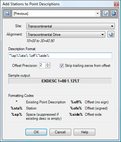
You may control the way the station and/or offset is added to the point using the Description Format. Various "special codes" may be used in this description format; a list of the codes is found in the dialog box. All other characters in the Description Format string are passed through unchanged. The Sample Output window shows what the result would be if the Description Format were applied to a point with 'EXDESC' as its current description. After changing the string in the Description Format, hit ENTER to update the sample output.
The following table illustrates some examples of Description Format strings and their results. The sample point is at Station 1+00, and has its Raw Description set to 'EXDESC'.
%sta% |
1+00 |
%sta% %ofs% |
1+00 -1.12 |
%sta%%sp%* |
1+00 EXDESC |
*%sp%%sta% %off%'%side% |
EXDESC 1+00 1.12'LT |
In the last two examples, the '%sp%' code only results in a space if the current description contains text.
Example
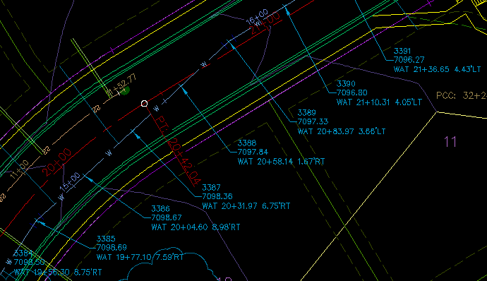
Say we have the points shown below:
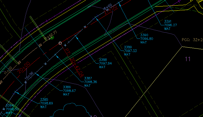
Let's assume we want to add the station and offset to the point labels, using the centerline stationing for the roadway (the red alignment and stationing in the image). First, select the points and run the StationPoints command. The dialog box shown above should appear. Assuming we use the same settings as seen in that image, the result looks like the following:
See Also
A "point browser". Displays selected points in a grid, including Station and Offset, with options for editing points, adding/removing them from Point Groups, and printing them to delimited output files (CSV, tab-delimited, etc.) or directly to a printer.
Find and Replace text in Point descriptions.
Display Points by Station and Offset, as measured along an Alignment. Results are displayed on screen and may also be written to a file.
Send the file created by the StaOff command to the default printer.
Key in a station on one alignment, and see the station/offset of that point as measured along another alignment.
