SincpacC3D
General Information
Command Summary

Alignment Cut/Fill Format
|
SincpacC3D
General Information
Command Summary
Alignment Cut/Fill Format |
Description
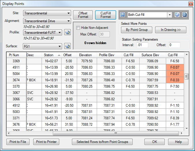
The Alignment Cut/Fill settings may be used to customize the display of the cut/fill columns in the DisplayPoints command.
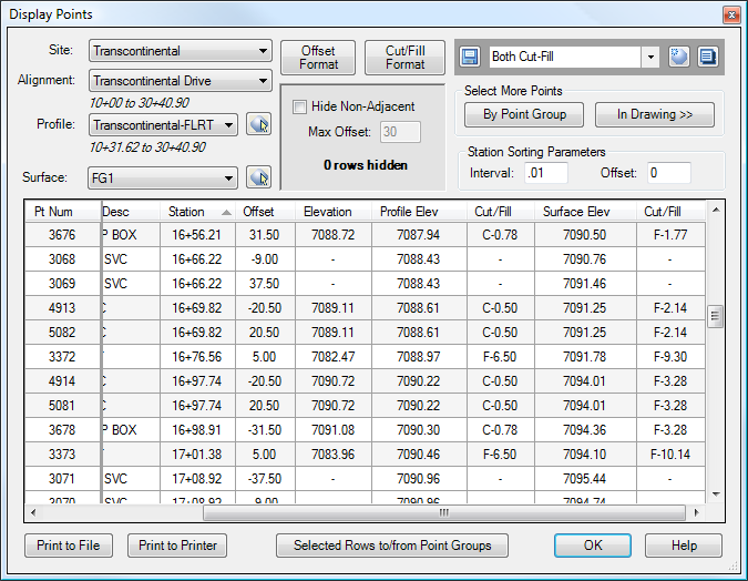
The image below shows the default settings for the Cut/Fill columns.
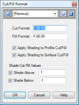
Clicking on the "Cut/Fill Display" button calls up the dialog box shown below. Use zeros and decimal points in the Cut and Fill format to indicate the number of digits. Any characters except for the zero strings are passed through unchanged. In the dialog box shown below, the settings have been altered slightly from the default settings, so that the cuts and fills will always be displayed with two digits before the decimal point. (The value of "00.00" indicates that values should always be displayed rounded to two decimal places, and with at least two digits before the decimal. Zeros are used to pad the result, if necessary.) Shading has also been enabled for both the Profile Cut/Fill and the Surface Cut/Fill, and enabled for all cuts and fills greater-than or equal-to 1 foot.
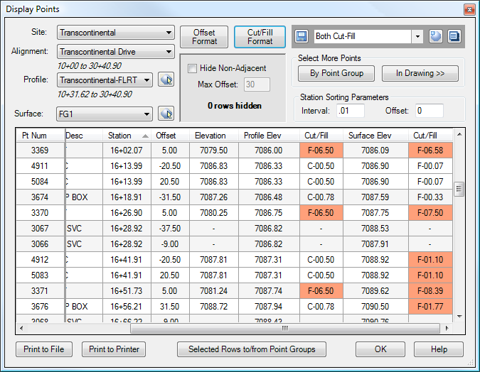
The result is shown below.
The dialog box below shows slightly-different settings. When entering the Cut/Fill values, positive numbers are treated as Fills, and negative numbers are treated as Cuts. So in this case, shading has been enabled only for fills greater-than or equal-to 0 and less-than or equal-to 1. In addition, in the dialog box below, the format of the Cut/Fill has been reset to the default, with only a single digit before the decimal point.
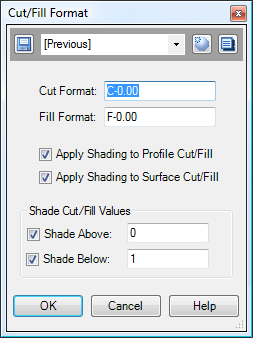
And below are the results. Note that only values with Fills between 0 and 1 feet are shaded.
See Also
Displays geometry and interval points along an alignment and profile, and can print the output to delimited output files (CSV, tab-delimited, etc.) or directly to a printer. May also be used to generate Cogo Points along Alignments, or display a Surface elevation at each station, along with a Cut/Fill between the Surface and Profile at each Station.
A Cogo Point browser, editor, and reporting tool, all rolled into one. Displays selected points in a grid, including Station and Offset, with options for editing points, adding/removing them from Point Groups, and printing them to delimited output files (CSV, tab-delimited, etc.) or directly to a printer. Also includes the ability to display a Surface elevation at each point, as well as a Cut/Fill between the Cogo Points and Profile/Surface.
