SincpacC3D
General Information
Command Summary

Pt2Feature
|
SincpacC3D
General Information
Command Summary
Pt2Feature |
Description
The Pt2Feature command datum-adjusts existing Civil-3D Points based on Feature Lines, 3D-Polylines, Survey Figures, or other linework.
Usage
Type Pt2Feature at the command line, and select the points you wish to change. You will see the prompt shown below. Select the sites that you want to search and specify the desired options, then hit the OK button. Or type "SE" to call up the Grading Settings dialog.

Example
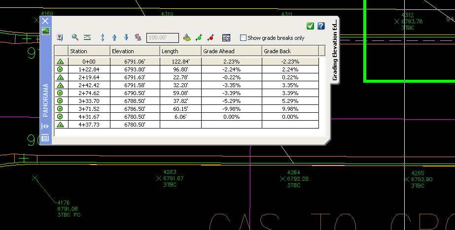
In the example below, the orange line at the back of curb is a feature line. The back of curb has elevations set as shown in the elevation editor, with Station 0+00 being near Point 4176 in the drawing.

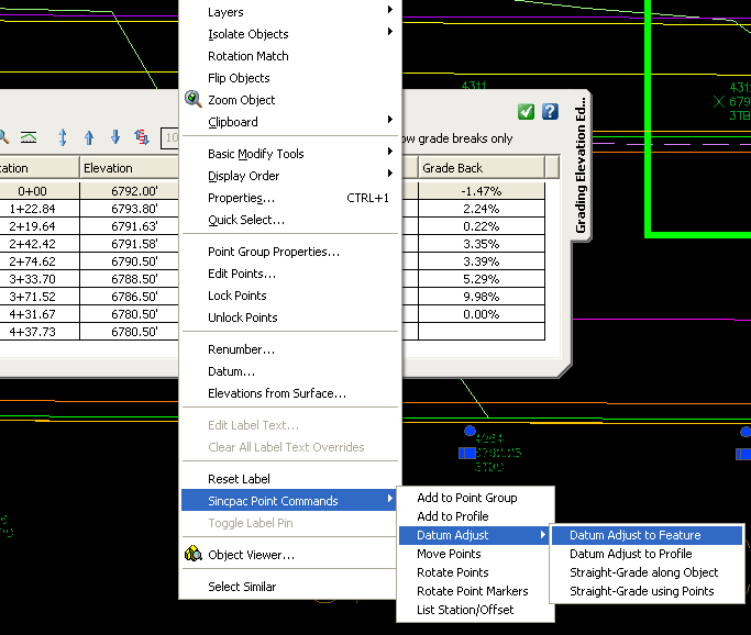
Now lets say we wish to change the elevation of Station 0+00 from 6791.06 to 6792.00. We can change the feature line by editing the elevations in the Elevation Editor, but then we also need to datum-adjust the points to match the new feature line elevation. To do that, we can start the Pt2Feature command. Or, we can select the points we wish to datum-adjust, right-click, and select the "Datum Adjust to Feature" option from the shortcut menu, as shown below. Note that we entered the new elevation of 6792.00 in the elevation editor before selecting the points.

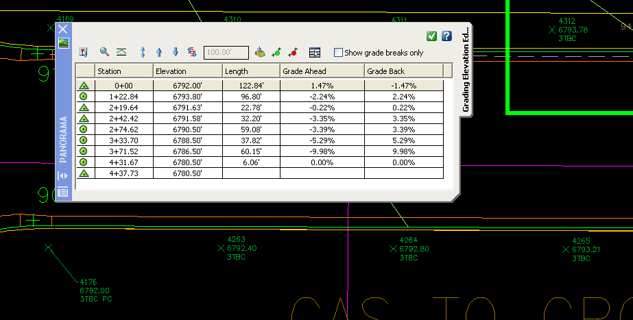
We then select the top of curb feature line, and the points are datum-adjusted to match the feature line, as shown below:

See Also
Datum-adjust points based on Profiles.
Manually create points with a variety of options, including getting the elevation from the pick point.