SincpacC3D
General Information
Command Summary

ScalePoints
|
SincpacC3D
General Information
Command Summary
ScalePoints |
Description
The ScalePoints command scales Civil-3D Cogo Points horizontally without applying a datum adjustment to the points.
Usage
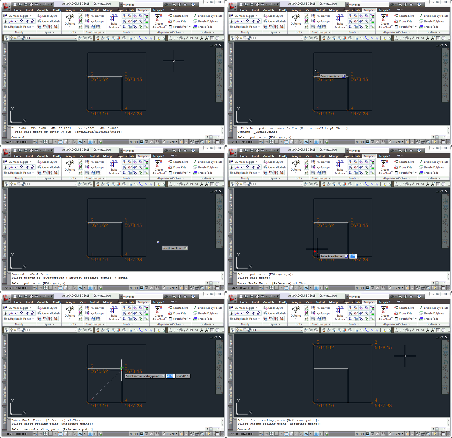
Type ScalePoints at the command line. You will be prompted to select the points you wish to scale. Hit RETURN or right-click to finish selecting objects, or type "PO" to select points by Point Group. You will then be prompted for a base point, and a scale factor. Alternatively, instead of entering a scale factor, you may type "R" to pick scaling points in the drawing.
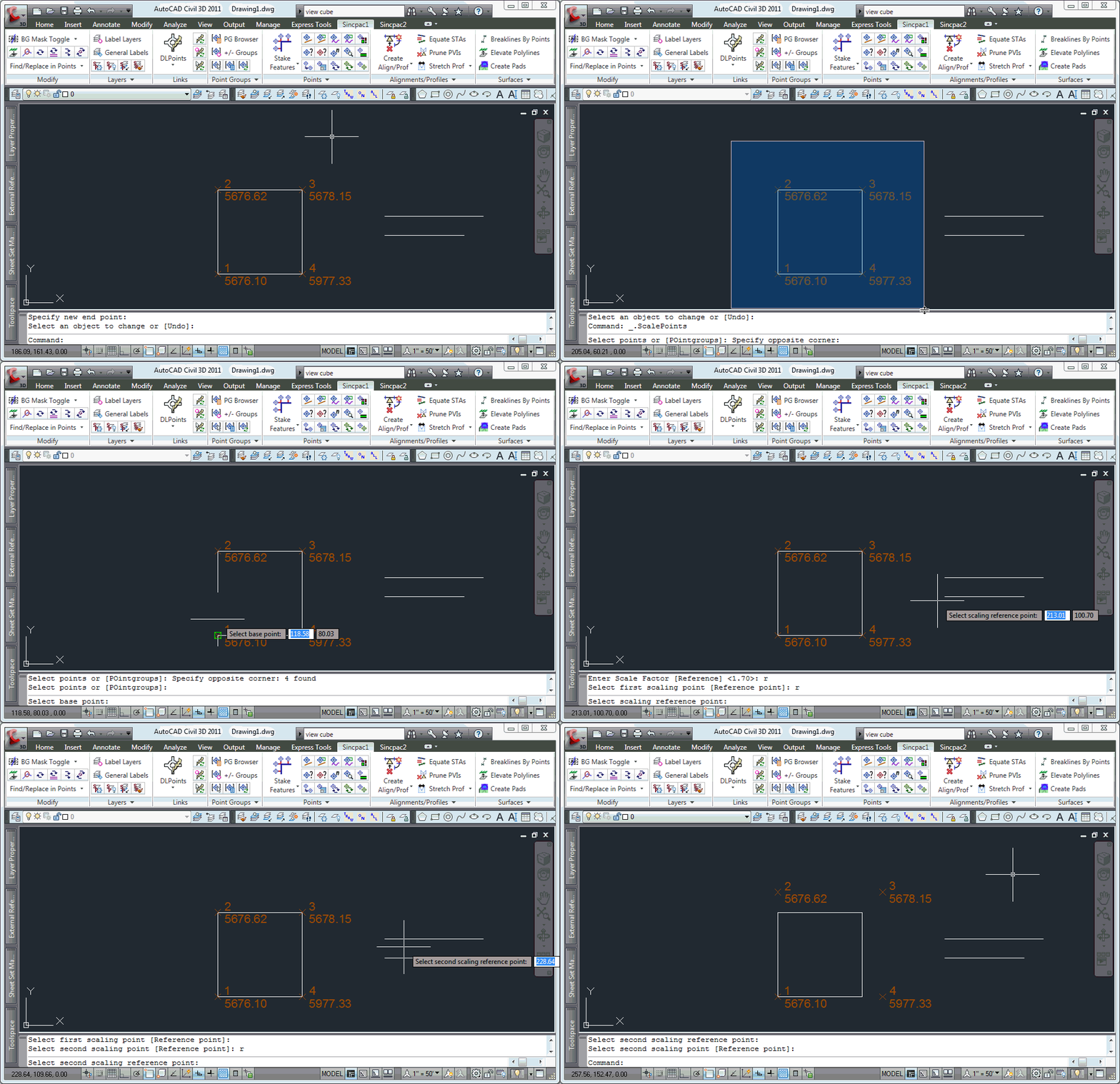
When selecting the scaling points, you may type "R" (for "Reference") to pick a new reference base point for calculating the scaling distance. This new reference point is only used for selecting the reference distance; the points are still scaled using the scaling base point. (See Example 2 below for an example of how this feature works.)
Examples
Example 1:
The following image illustrates the simplest usage of the ScalePoints command. The user selects the lower-left corner as the base point for scaling, then hits "R" to select reference points.

Example 2:
The following image illustrates how we may use different base points for picking our reference distance. The points are scaled from the scaling base point. The user then hits "R" again to change the reference point before picking each scaling point.

See Also
Find and Replace text in the Raw Description for points.
Displays a list of available point numbers in the command window.
Move points in the drawing. Points are only moved horizontally, with no datum adjustment, and may be selected by Point Group.
Set the next point number for point creation.
Add and/or remove selected Civil-3D Points to/from one or more existing Point Groups.
Manually create points with a variety of options, including getting the elevation from the pick point.
Rotate objects to match a linear object. Each selected object is rotated to match the bearing of the closest point on the linear object.
Rotate selected objects. Each object is rotated individually around its insertion point. When used on Cogo Points, this command rotates the Point Marker. When used on MLeaders that have a single leader, the MLeader is rotated around the arrowhead.
Rotate Civil-3D Point Markers.
Rotate Civil-3D Point locations, with an option to select by point group.
Rotate objects to match a selected object. May also be used to rotate objects to match segments of polylines, Feature Lines, Survey Figures, or Parcels. When selecting a linear object, all objects are rotated to match the bearing of the selected point on the linear object.
Rounds selected Cogo Point elevations to the specified interval.
Rotate selected objects around a selected pick point by a set amount.
Displays a list of used point numbers in the command window.
Zoom to a Cogo Point by typing the Point Name or Number in the command window.