SincpacC3D
General Information
Command Summary

SPPointElevationsFromSurfaces
|
SincpacC3D
General Information
Command Summary
SPPointElevationsFromSurfaces |
Description
The SPPointElevationsFromSurfaces command allows the user to show point tables with the elevations from 2 surfaces, in addition to the point elevation.
After starting the SPPointElevationsFromSurfaces command, you will be presented with a form from which you select the points, or PointGroups, to compare, select the 2 surfaces to use, and the 2 UserDefinedProperties (these must be pre-defined as elevation types).
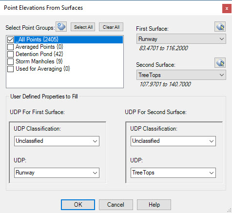
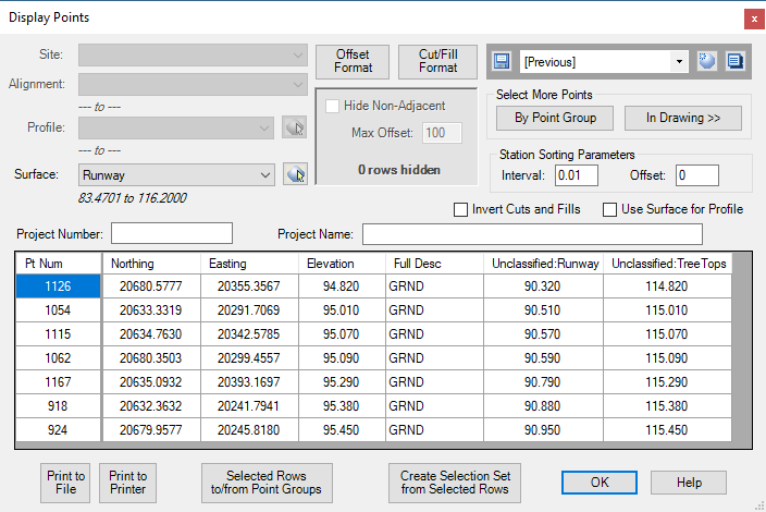
Once the selection is complete the selected points will have the respective UDP's assigned the surface elevations. You can now assign a label style to the points which displays those UDP's, use the DisplayPoints Sincpac tool to create a report, or export the points out to a text file. If you need to also include station/offset information, use the DL_Points tool to link the points to alignment(s).
See Also